About Marine Magnetic Surveys
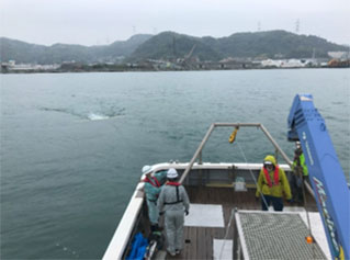
Ocean Engineering Corporation (OEC) is able to offer clients Marine Magnetic Surveying in order to identify magnetic anomalies which may potentially be influential obstructions/considerations in marine construction fields.
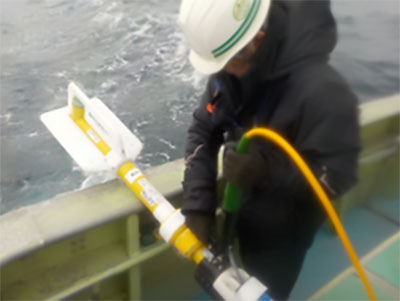
OEC is able to conduct magnetic surveying using Geometrics G882 Cesium Vapor High Performance magnetometers with the following survey capabilities:
・Single (1) Towed G882 in waters up to about 20m deep.
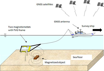
・Parallel (2) Towing G882s with a Geomatrix TVG frame in waters up to about 50m deep.
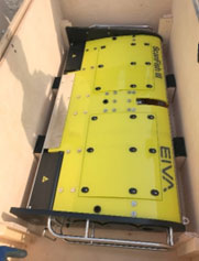
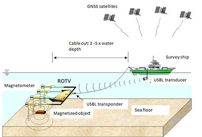
・Quadruple (4) Towed G882s employing an EIVA ROTV Scanfish Ⅲ in waters up to 400m deep.
・Single Towed (1) G882 in combination with Edgetech 2000DSS (Tandem Twoing) in waters up depths of about 1500m. This method allows for simultaneous surveys together with SSS (Side-Scan Sonar) and SBP (Sub-bottom profiler).
Applications
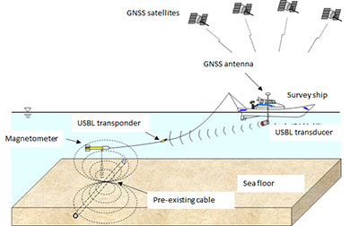
a) Identification of the location of pre-existing submarine cables
During cable route surveying, which is conducted to facilitate the planning and construction of new cable-laying, one part of the operation is a magnetic survey which is generally employed to identify the location of pre-existing buried submarine cables and obstructions such as:
・ Submarine communication cables
・ Submarine power cables
・ and pipelines for oil/gas/water.
b) Creating Magnetic Anomaly Maps around seabed points for such geotechnical investigations as borehole drilling and CPT (Cone Penetration Test)
c) Creating Magnetic Anomaly Maps for OWF (Offshore Wind Farms
Magnetometer survey operations using a ROTV allow us to perform high data density and high data quality magnetic surveys in waters up to 400m deep. This technique can cover all seabed zones not only for Fixed Bottom Type WFs (Wind Farms) but also Floating Type WFs.